News & Bulletins
HRBRRD Newsletter
BLACK RIVER REGULATING DISTRICT TURNS 100
For Immediate Release: 08/13/19
Contact:
John Callaghan | jcallaghan@hrbrrd.ny.gov | (518) 912-3986
BLACK RIVER REGULATING DISTRICT TURNS 100
Water Regulation Body Incorporated August 14, 2019; First Board Meeting Held September 20, 1919
Regulating District Hosting Open House at Stillwater Reservoir on Saturday
WATERTOWN – The Hudson River – Black River Regulating District (HRBRRD) is commemorating the 100th anniversary of the incorporation of the Black River Regulating District on August 14, 2019.
Following a petition for the Regulating District’s formation which was published on February 19, 1919, the Black River Regulating District was statutorily established in May, 1919, and officially incorporated 100 years ago today on August 14, 1919.
On September 6, 1919 Governor Alfred E. Smith appointed the first Board of the Black River Regulating District: J. Victor Baron, president of the Sherman Paper company, John Byron Taylor of Northern New York Utilities, and James A. Outterson of the De Grasse Paper company. The first meeting of the board was held on September 20, 1919 at Taggarts Paper Company in the City of Watertown, NY.
Formed to meet an urgent need on the Black River to improve drinking water, sanitation, regulate flooding, improve navigation, and maximize hydroelectric power capabilities, it was the first river regulating district to be created in the state under the provisions of the Machold Storage Act passed by the legislature in 1915. A second, the Hudson River Regulating District, was formed in 1922. The two boards were combined in 1959 by the New York State Legislature to create the HRBRRD.
“We are committed to continuing the important mission begun by our predecessors 100 years ago on behalf of New Yorkers,” Mark Finkle, Chair of the HRBRRD, said. “A century later, the flood protection and flow augmentation benefits which are inherent to the Regulating District’s operations in the Black River Area remain as important as ever.”
John Callaghan, Executive Director of the HRBRRD, said, “After a century of operations, we look forward to playing an integral role in supporting the production of clean, renewable hydroelectric power, providing flood protection and ecological benefits, and enhancing recreation along the Black River and its tributaries for the next 100 years.”
The HRBRRD will host an open house at its Stillwater Dam facility from 9 am to 5 pm on Saturday, August 17 to acquaint members of the public and visitors with its mission and operations. The HRBRRD Board will meet in Watertown on September 10, 2019 and will observe the 100th anniversary of the inaugural meeting.
The Black River Regulating District (BRRD) was the first regulating district in the state, having been established by the State Legislature in May, 1919 and incorporated on August 14, 1919. On September 6 of the same year Governor Alfred E. Smith appointed the first board, with the first board meeting held on September 20. Edwin S. Cullings was appointed Secretary to the Board and Chief Engineer on December 24, 1919.
After years of work surveying in the Black River watershed, the General Plan for the Regulation of the Flow of the Black River and Certain of its Tributaries was adopted by the BRRD Board on March 22, 1920, and approved by the Conservation Commission April 20, 1920.
The BRRD held public hearings on its first major project in 1921, the enlargement of the Stillwater Dam. In 1923 the contract was awarded to Scott Brothers of Rochester in the amount of $226,131, and construction began in 1924. The gates on the enlarged dam were closed on February 11, 1925, and were then opened for the first release of water on May 6, 1925.
In 1924 under the direction of Black River Regulating District Chief Engineer Edwin S. Cullings, work began on raising the existing dam on the Beaver River at Stillwater Reservoir by 19 feet, increasing the storage capacity from 9 million cubic feet to 4.5 billion cubic feet. Over 3,500 acres of land were cleared in the process, along with the relocation of approximately a mile and a half of railroad track. The Regulating District owns and operates several other dams in the Black River watershed, including Old Forge, Sixth Lake, and Hawkinsville.
HRBRRD Newsletter
Plant Operator – Position Opening
The Hudson River-Black River Regulating District, a New York State Public Benefit Corporation responsible for regulating the flow of the Hudson and Black Rivers, is seeking applications for the position of Plant Operator at the Conklingville Dam located (on Great Sacandaga Lake) in Hadley, NY.
The Plant Operator would, under the supervision of the Area Administrator, assist the Principal Plant Operator in performing a wide variety of tasks related to the operation and maintenance of the Conklingville Dam. Primary duties include operation, maintenance, inspection, and repair of the dam and facilities; and taking and recording hydrological and meteorological data.
Salary range $36,732 – $46,076. Benefits include medical, dental, and vision insurance, deferred compensation plan, State retirement, paid vacation, holidays, sick leave, and personal time.
A high school diploma and experience in a related field is required. Successful candidate should possess experience in maintenance or mechanical work. Must be physically able to work outdoors in all weather conditions. A valid New York State driver’s license is required and a CDL is preferred.
As an Equal Opportunity Employer, minorities, women, and veterans are encouraged to apply.
Qualified candidates should forward their resume and a letter of interest by May 10, 2019 to:
Stephanie Ruzycky, Compliance Officer
Hudson River-Black River Regulating District
737 Bunker Hill Road
Mayfield, NY 12117
HUDSON RIVER-BLACK RIVER REGULATING DISTRICT BOARD VOTES TO APPOINT NEW EXECUTIVE DIRECTOR JOHN C. CALLAGHAN TO LEAD CENTURY-OLD WATER REGULATION & FLOOD PROTECTION ORGANIZATION
For Immediate Release: 04/11/19
Contact:
John Hodgson | jhodgson@hrbrrd.ny.gov | (518) 661-5535
HUDSON RIVER-BLACK RIVER REGULATING DISTRICT
BOARD VOTES TO APPOINT NEW EXECUTIVE DIRECTOR
JOHN C. CALLAGHAN TO LEAD CENTURY-OLD WATER REGULATION & FLOOD
PROTECTION ORGANIZATION
WATERTOWN – The Board of the Hudson River-Black River Regulating District (HRBRRD) has voted unanimously to appoint John C. Callaghan as its new executive director, it announced today.
Callaghan, a U.S. Coast Guard veteran, comes to the position from a career at the New York State Canal Corporation spanning two decades, where he served in various roles including tugboat captain, canal traffic agent, director of policy implementation and planning, acting director of the Canal Corporation and – most recently over the last eight years – as deputy director and acting executive deputy director. He was appointed at the HRBRRD Board’s April 9th meeting in Watertown, and will begin in the new role on April 15th.
Chairman Mark M. Finkle said, “After a thorough search and interviews with several qualified candidates, Mr. Callaghan emerged as having the skill set, level of experience and leadership ability perfect for this position. We found him to be uniquely qualified for the inherent challenges of the job, and could not be happier to have him lead our team of dedicated and professional employees.”
John C. Callaghan said, “This is an amazing organization that has been doing extremely important work for the people of New York State, often with little notice or acclaim, for the better part of a century. I know I will be able to help the District accomplish its important mission and provide strong leadership for its dedicated staff. I am grateful for the opportunity and excited to be joining this exceptional team.”
Chairman Mark M. Finkle praised the performance of John Hodgson, who had been serving as interim executive director, and will return to his duties as administrator for the District’s Hudson River and Black River areas.
“The Board commends John Hodgson for his leadership, professionalism and exemplary performance while serving as interim executive director, while continuing his duties as administrator and leading the search for a new executive director,” Finkle said.
About the Hudson River-Black River Regulating District
The mission of the HRBRRD – which traces its roots to the formation of the Black River Regulating District 100 years ago this year – is to protect public health and safety by regulating the flow of waters in the upper Hudson River and the Black River. The Black River and Hudson River Regulating Districts were formed by the New York State Legislature in 1919 and 1922, respectively, to regulate water flows within those river basins and reduce flooding. The two districts were combined in 1959. As part of its mission, the HRBRRD maintains five reservoirs in upstate New York, including the Great Sacandaga Lake, New York State’s largest reservoir.
HRBRRD Newsletter
Chief Fiscal Officer – Job Opening
The Hudson River – Black River Regulating District, a New York State public benefit corporation, that regulates the flow of the Upper Hudson River and the Black River, is seeking a Chief Fiscal Officer responsible for managing and controlling all aspects of the fiscal, accounting and some operational functions of the organization. Demonstrated progressive experience in a not-for-profit/government environment is preferred, BS in Accounting or Business Administration required, CPA or MBA preferred. Detail oriented, good communication and organizational skills. Ability to work in a, hands on environment and handle multiple priorities and deadlines. Travel between offices required. In addition to a competitive salary commensurate with experience, we offer an outstanding benefits package, including medical, dental and vision insurance, deferred compensation plan, State retirement, paid vacation, holidays, sick leave, and personal time. Official work station will be Mayfield / Albany offices.
Interested candidates should reply, with a letter of interest, salary requirement, and a comprehensive education/ professional resume to:
Richard Ferrara, Human Resources,
Hudson River – Black River Regulating District,
737 Bunker Hill Road, Mayfield, New York 12117
Vertical Datum Upgrade
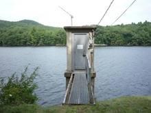
Great Sacandaga Gauge Station at Conklingville
Consistent with the USGS planned conversion from National Geodetic Vertical Datum of 1929 (NGVD29) to the North American Vertical Datum of 1988 (NAVD88), the Hudson River – Black River Regulating District will be upgrading the datum used to record water level elevation at all of its reservoirs.
Effective February 1, 2019 the datum at surface-water and ground-water stations operated by the Hudson River – Black River Regulating District in partnership with the USGS will be converted from the National Geodetic Vertical Datum of 1929 (NGVD 29) to the North American Vertical Datum of 1988 (NAVD 88).
NGVD 29 has been the benchmark used by surveyors and engineers as the standard position from which measurements are taken. Originally called the Sea Level Datum of 1929, it was created for vertical control surveying in the United States, and is what is referred to by the inaccurate term “sea-level.” The sea itself is not level, but is subject to variations caused by currents, wind, barometric pressures, temperature, and the topography of the sea floor. Because mean sea level at one location can be quite different than mean sea level at another location, it is not an accurate benchmark for measurement. Satellite technology has also discovered ground elevations that have risen or fallen due to geological activity and the effects of gravity.
Technological advancements have created the ability for greater accuracy, resulting in the North American Vertical Datum of 1988 (NAVD 88). The NAVD 88 was completed in June of 1991, contains an additional 100,000 miles of leveling and was constrained only to the primary tidal benchmark at Father Point/Rimouski, Quebec, Canada. It is a great improvement over its predecessor in terms of mathematical techniques employed as well as being based on the Earth’s observed gravity field. NAVD 88 is compatible in principle with the Geoid, the mathematical system of describing the relation of the Earth’s gravity field to elevations.
All federal agencies are required to use NAVD 88. The US Army Corp of Engineers, the Federal Emergency Management Agency and United States Geological Survey have all adopted the new datum.
For the rivers, streams and reservoirs that are monitored by the Regulating District within the Black and Hudson River watersheds, the NAVD 88 elevation number is a shift of approximately .88 to .11 feet lower than the elevation in the NGVD 29 standard. This variation is due to geographical differences. For example, a water level for the Great Sacandaga Lake is 771.00 ft. and will be 770.12 in the NAVD 88 standard. The difference is referred to as the “shift between datums”. Only the numerical value for the elevation changes; the depth and volume remain the same.
Marcy, D. (2016, July 01). Why am I “Mean” About Sea Level? Retrieved from https://geozoneblog.wordpress.com/2012/09/24/why-am-i-mean-about-sea-level/
NEW ORLEANS DISTRICT. (n.d.). Retrieved from https://www.mvn.usace.army.mil/Missions/Engineering/Survey-Section/FAQ/
Sarasota County Water Atlas. (n.d.). Retrieved from http://www.sarasota.wateratlas.usf.edu/shared/learnmore.asp?toolsection=lm_navd88
Vertical Datum Upgrade. (n.d.). Retrieved from https://www.swfwmd.state.fl.us/resources/data-maps/vertical-datum-upgrade
Information from FEMA regarding Vertical Datum Upgrade
HRBRRD Board Meeting
Please take notice that the Board of the Hudson River-Black River Regulating District will conduct two (2) meetings for the transaction of such business as shall come before the said Board at the Warren County Municipal Center, 1340 State Route 9, Conference Room 5110, Lake George, NY 12845 on Tuesday, December 11, 2018 beginning at 10 AM. The Audit Committee Meeting will convene first, followed by the Regular Board Meeting. A video recording of the Meeting shall be accessible from the District’s website (www.hrbrrd.ny.gov) not later than two business days after the close of the meeting.
Richard J. Ferrara
Secretary-Treasurer
Summer 2018 Reservoir Operation
Localized rain storms and occasional heavy precipitation, as well as a few National Weather Service notices of flash flooding in the Hudson River and Black River watersheds, has had the tendency to leave the casual observer believing that both river systems have received “plenty” of water throughout the summer. Those situations have also made it difficult for the same casual observers to understand why the Great Sacandaga Lake and Stillwater Reservoir elevations have been lower than normal since early June.
In the simplest of terms, reservoir operation is centered on the quantity of water entering the reservoir (inflow) and quantity of water leaving the reservoir (release). The elevation of the reservoir varies depending upon whether the inflow to the reservoir is greater or less than the release of water from the reservoir. Release of water is controlled, inflow is not.
When the amount of water entering a reservoir is greater than the amount leaving the reservoir, the elevation of the reservoir increases. Conversely, when the amount of water entering is less than the amount exiting, the elevation decreases. In the first scenario – when the inflow exceeds the release – water is stored in the reservoir, in the second scenario it is not.
The release of water from a reservoir is typically a known and determined quantity and, generally, based on fixed demands downstream of the reservoir such as waste assimilation, environmental concerns, and industrial needs, to name a few.
Despite periodic rainfall in June, July, and August, river flow in the Hudson and Black River watershed continued to remain significantly below average. Hudson River monthly average flow measured only 47% of historic average in June and 47% and 48% in July and August, respectively.
Black River monthly average flow (without augmentation from Stillwater Reservoir) measured approximately 49%, 57%, and 71% of historic average in June, July, and August, respectively.
This lower than average natural river flow produced greater than normal demand for the release of water from the reservoirs.
The amount of water entering a reservoir, or inflow, is dependent upon the amount of precipitation that falls on the reservoir watershed and how much of that precipitation runs into the reservoir.
During the three month period June through August the Great Sacandaga Lake and Stillwater reservoir received significantly less inflow than historically enters the reservoirs.
| Percent of Average Reservoir Inflow – June, July, August 2018 | |||
| Reservoir Facility | June | July | August |
| Great Sacandaga Lake | 35% | 24% | 65% |
| Stillwater | 41% | 14% | 18% |
The product of greater than normal demand for the release of water and significantly less inflow than historically enters the reservoirs sustained a condition similar to the second scenario detailed above and, for the three month period, resulted in inflow which was less than the release causing the elevation of the reservoirs to decrease.